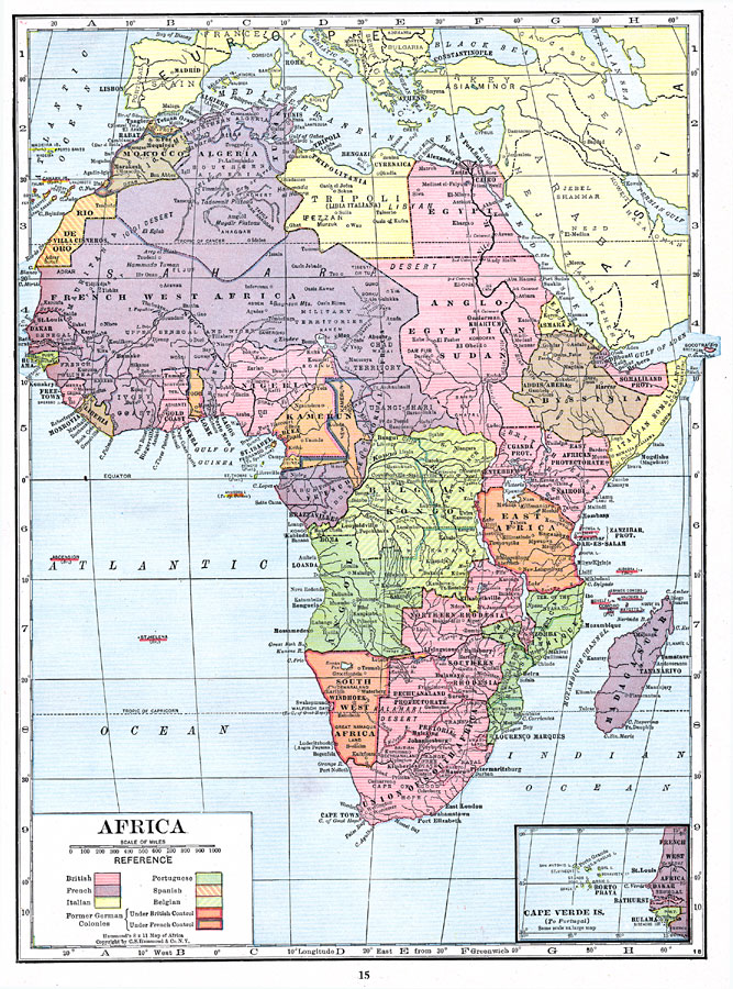
Description: This map is of Africa after World War I. The scramble by Italy, Belgium, and Germany to create colonies in order to keep up with the British, French, and Spanish Empires was played out in Africa, the last remaining continent yet to be completely divided up between European powers. Increased nationalism resulted from this imperialism, and contributed to the heightened tensions leading up to World War I. Germany lost all of their African colonies at the end of the war, contributing to feelings of resentment that would come to a head 21 years later with the start of World War II.
Place Names: A Complete Map of Africa, Algeria, �Egypt, �Madagascar, �Lybia, �Ethiopia, �Nigeria, �Somalia, �South Africa, �Sudan, �Morocco, �Tunis, �Tripoli, �Libia Italiana, �Rio De Oro, �French West Africa, �Anglo-Egyptian Sudan, �Eritrea, �Somaliland, �Italian Somoliland, �Abyssinia, �S
ISO Topic Categories: boundaries,
society,
inlandWaters
Keywords: Post-WWI Africa, physical, �political, �historical, �colonization, kVersailles, physical features, country borders, WWI, boundaries,
society,
inlandWaters, Unknown, 1918
Source: , The Victory Atlas of the War (New York, NY: Charles Scribner's Sons, 1918) 15
Map Credit: Courtesy the private collection of Roy Winkelman |
|