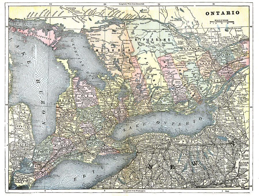
Description: A map from 1903 of the Ontario province south of Lake Nipissing and the Ottawa and French Rivers. The map shows county boundaries, major cities and towns, railways, rivers, lakes, and islands of the Great Lakes.
Place Names: Canada, Toronto, �Ontario, �Kingston, �Lake Ontario, �Lake Erie, �Georgian Bay, �Lake Huro
ISO Topic Categories: boundaries,
inlandWaters,
transportation
Keywords: Ontario, physical, �political, �transportation, physical features, country borders,
major political subdivisions,
county borders, railroads, boundaries,
inlandWaters,
transportation, Unknown,1903
Source: Day Otis Kellogg, Encyclopædia Britannica Vol. XVII (New York, NY: Werner Company, 1903) 774
Map Credit: Courtesy the private collection of Roy Winkelman |
|