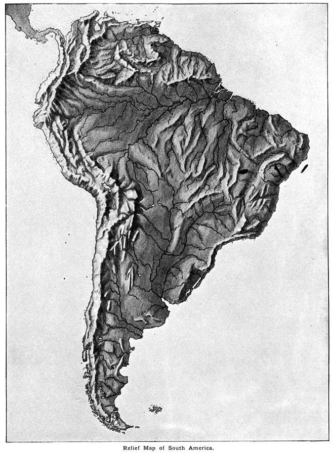
Description: A relief map from 1890 showing terrain features of South America. "South America is the fourth continent in size, and strikingly resembles North America in the arrangement of its relief–forms. It has, like the latter, a predominant mountain–system in the west, two secondary systems in the east, and three low plains intervening. The predominant mountain–system is called the Andes, and trends from the Strait of Magellan to the Isthmus of Panama, forming an unbroken mountain–wall." — Brewer, 1890.
Place Names: A Complete Map of South America, Argentina, �Bolivia, �Brazil, �Chile, �Columbia, �Ecuador, �Paraguay, �Peru, �Uruguay, �Venezuel
ISO Topic Categories: elevation,
environment,
geoscientificInformation,
inlandWaters
Keywords: Relief Map of South America, physical, �relief maps, �elevation, �physical features, elevation,
environment,
geoscientificInformation,
inlandWaters, Unknown,
Unknown,1890
Source: William H. Brewer Ph.,D., Warren's New Physical Geography (Philadelphia, PA: Cowperthwait and Company, 1890) 34
Map Credit: Courtesy the private collection of Roy Winkelman |
|