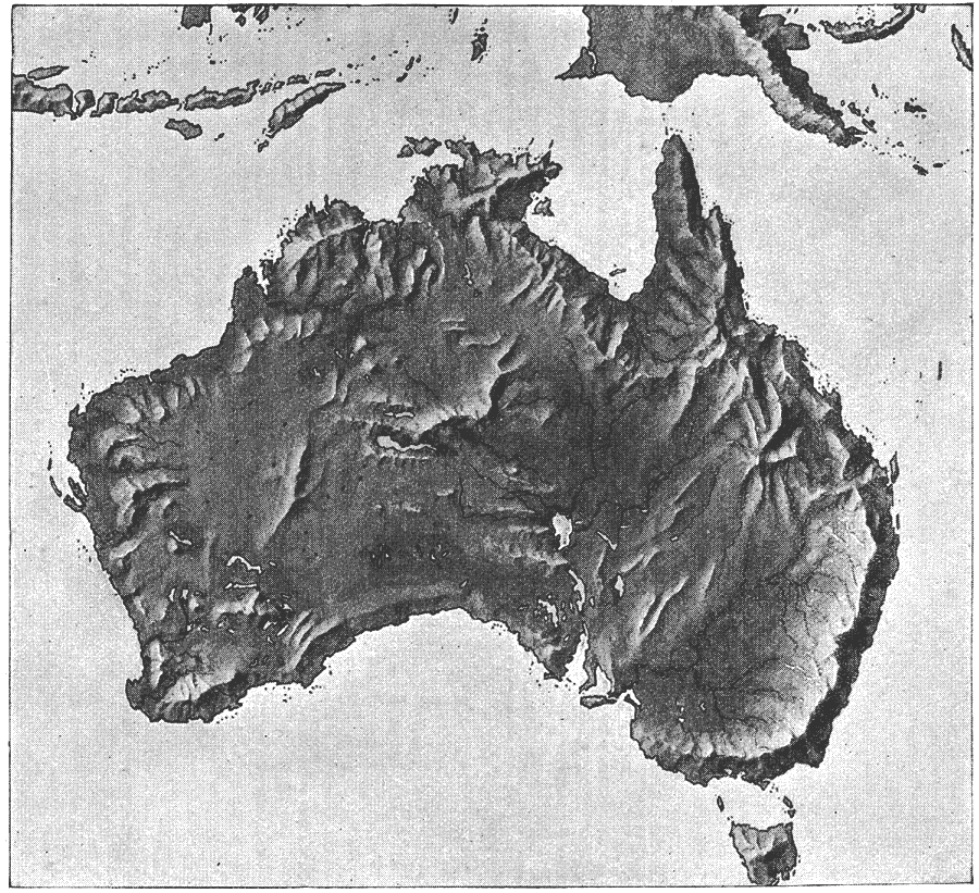
Description: "Australia is the smallest of the six large land-masses which are now classified by most geographers as continents. The arrangement of its relief-forms resembles that of Africa. The greater part of it is a low plateau, with a general altitude of from 500 to 600 feet. Near the coast, mountain-chains rise upon the margin of the plateau around the whole continent. The Australian Alps and the Blue Mountains in the east and southeast are the only high chains, and may be considered the Predominant System. Mt. Townsend (7531 feet), Mt. Clark (7256 feet), and Mt. Kosciusko (7176 feet) are the highest peaks. The western coast-chains are much lower, the greatest elevation not exceeding 4000 feet, and there are some low ranges in the interior. Like Africa, Australia has bays and peninsulas, and, except in the north, its coastline is comparatively unbroken. The interior plateau slopes gently down to the south and the low plain on the Australian Bight. Except at he base of the mountains, the greater part of the plateau is a dry stony desert. The plain drained by the Murray River and its tributary, the Darling, and the eastern coast-plains are the most thickly settled and the best-known portions of Australia. The western part and the interior have never been thoroughly explored, and the knowledge of the details of the structure is vague. Several depressions are known to exist in the plateau which contain lakes that vary in extent with the season." (— Brewer, 1890)
Place Names: A Complete Map of Australia,
ISO Topic Categories: elevation,
inlandWaters
Keywords: Relief Map of Australia, physical, �relief maps, �elevation, kRelief, physical features, elevation,
inlandWaters, Unknown, 1890
Source: William H. Brewer Ph.,D., Warren's New Physical Geography (Philadelphia, PA: Cowperthwait and Company, 1890) 40
Map Credit: Courtesy the private collection of Roy Winkelman |
|