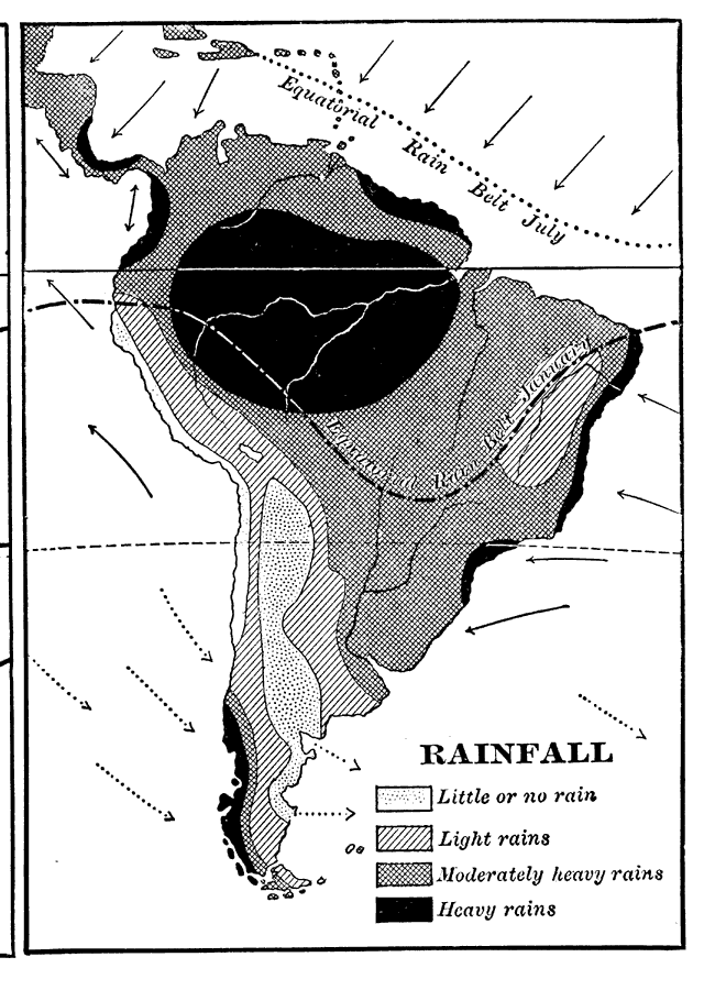
Description: A map from 1898 showing mean annual rainfall in South America. The map shows the equatorial rain belt in July and in January, the direction of prevailing winds and their effect on rainfall patterns. The map shows regions ranging from little or no rainfall to regions of heavy rains. "The most plainly marked seasons are the wet and dry, and they are determined by the position of the equatorial rain belt...The enormous amount of rain which falls on the Atlantic slope of South America gives to it some of the greatest rivers in the world. The Amazon, while not so long as the Mississippi–Missouri, has a larger basin and discharges much more water into the ocean." — Redway, 1898.
Place Names: A Complete Map of South America, rainfall, �equatorial rain bel
ISO Topic Categories: climatologyMeteorologyAtmosphere
Keywords: Rainfall in South America, meteorological, �historical, kClimate, rainfall, climatologyMeteorologyAtmosphere, Unknown,1898
Source: Jacques W. Redway and Russell Hinman, Natural Advanced Geography (New York, NY: American Book Company , 1898) 104
Map Credit: Courtesy the private collection of Roy Winkelman |
|