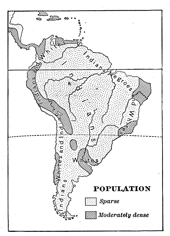
Description: A base map from 1898 of the population density and general ethnic make–up of South America. The map shows regions of sparse and moderately dense population densities, and the regions populated predominately by Indians, whites, and negroes. "The most advanced tribe were the Incas, who lived near Lake Titicaca. With the aid of irrigation and fertilizers they cultivated corn, potatoes, and cotton; they had domesticated the llama as a beast of burden, and the alpaca for its wool, which they wove into cloth; they built fine roads and immense buildings of stone; they made bronze and knew how to work gold and silver, of which they made beautiful ornaments and utensils. They had conquered nearly all the tribes of the Andes region and formed them into a great confederacy or nation, which numbered several million people." — Redway, 1898.
Place Names: A Complete Map of South America, populatio
ISO Topic Categories: society
Keywords: Population of South America, statistical, �historical, kEthnic, kPopulation, population, society, Unknown,1898
Source: Jacques W. Redway and Russell Hinman, Natural Advanced Geography (New York, NY: American Book Company , 1898) 107
Map Credit: Courtesy the private collection of Roy Winkelman |
|