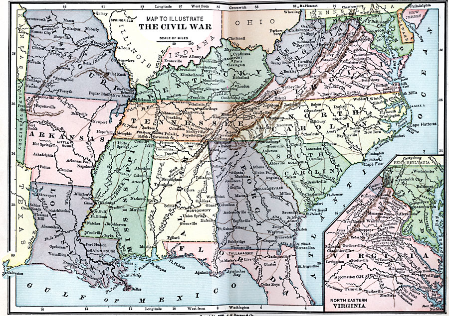
Description: A map from 1885 of the southern States during the American Civil War (1861–1865). The map shows state boundaries and capitals (note Milledgeville, Georgia, State Capital until 1868), major cities, towns, and ports, railroads, mountain systems, and rivers of the region. An inset map details northeastern Virginia.
Place Names: Civil War, Philadelphia, �Washington D.C., �Jacksonville, �Mobile, �New Orleans, �Gettysbur
ISO Topic Categories: boundaries,
inlandWaters,
location,
oceans,
intelligenceMilitary
Keywords: Civil War, physical, �historical, physical features, major political subdivisions, Civil War, boundaries,
inlandWaters,
location,
oceans,
intelligenceMilitary, Unknown, 1861–1865
Source: Joel Dorman Steele, A Brief History of the United States (New York, NY: American Book Company, 1885) 214
Map Credit: Courtesy the private collection of Roy Winkelman |
|