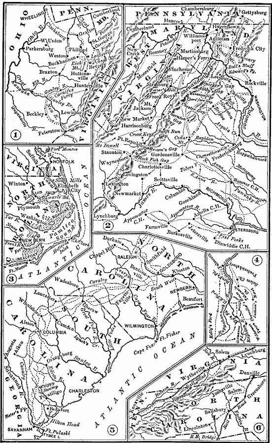
Description: A series of maps showing important campaigns and regions of the American Civil War (1861–1865). The maps show important cities and towns, railroads and campaign routes, terrain and coastal features, and rivers. The maps include (1) Western Virginia (Philippi, Rich Mountain, Carrick's Ford, Carnifex Ferry, and Cheat Mountain), (2) Central Virginia (Bull Run, Ball's Bluff, Fredericksburg, Harper's Ferry, Gettysburg, Shenandoah Valley, New Market, Richmond, Petersburg, Appomattox, and others), (3) Pamlico Sound (Norfolk, Hatteras Inlet, New Bern, Elizabeth City), (4) Fredericksburg on the Rappahannock, (5) Coastal North and South Carolina (Savannah, Charleston, Columbia, Fayetteville, Goldsboro, and Raleigh), and (6) the Virginia–North Carolina area near Danville.
Place Names: Civil War, Raleigh, �Columbia, �Savannah, �Washington D.C
ISO Topic Categories: boundaries,
intelligenceMilitary,
inlandWaters,
location,
oceans
Keywords: Civil War, physical, �political, �transportation, �historical, physical features, major political subdivisions, railroads, Civil War, boundaries,
intelligenceMilitary,
inlandWaters,
location,
oceans, Unknown, 1861–1865
Source: Joel Dorman Steele, A Brief History of the United States (New York, NY: American Book Company, 1885) 223
Map Credit: Courtesy the private collection of Roy Winkelman |
|