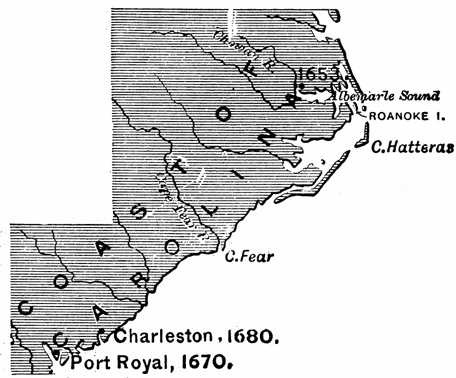
Description: A base map of the coast of the Carolinas showing the early European settlements of Roanoke Island (1585), the Albemarle Settlements (1653), Port Royal (1670), and Charleston (1680).
Place Names: Early America 1400-1800, Charleston, �Port Royal, �Colonial America, �Englis
ISO Topic Categories: inlandWaters,
location,
oceans
Keywords: The Carolinas, physical, physical features, inlandWaters,
location,
oceans, Unknown, 1653–1680
Source: Edward Eggleston, The Household History of the United States and Its People (New York, NY: D. Appleton and Company, 1898) 57
Map Credit: Courtesy the private collection of Roy Winkelman |
|