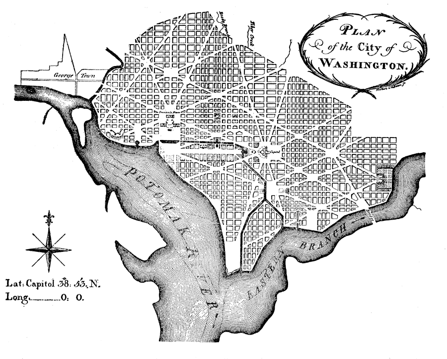
Description: A plan of the city of Washington from 1790. The lat/long figures on the map shows a longitude of 0° 0&quo; based on the Washington Prime Meridian passing through the Capitol. "This city was laid out by Peter Charles L'Enfant, who published his plan 'projected in pursuance of an Act of Congress, passed 16th July, 1790, establishing the permanent seat on the bank of the Potomic.'" (— Winsor, 1888) The original city plans called for a city 10 square miles and centered on the Capital building.
Place Names: District of Columbia, Washington D.C., �Washington, �Georgetow
ISO Topic Categories: boundaries,
inlandWaters
Keywords: Plan of the City of Washington, physical, �political, �transportation, �historical, �city planning, physical features, local jurisdictions, roads,
water routes, American Revolution, boundaries,
inlandWaters, Unknown,March 1792
Source: Justin Winsor, Narrative and Critical History of North America Vol. VII (Boston, MA: Houghton, Mifflin and Company, 1888) 336
Map Credit: Courtesy the private collection of Roy Winkelman |
|