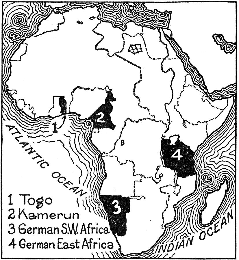
Description: This map shows the African colonies lost by Germany in 1916 during World War I. "At the beginning of 1916 only two colonies remained to Germany, Kamerun and German East Africa. Kamerun was completely overrun by Belgian, British and French troops in January, and in February a powerful Boer army from South Africa, under the command of Jan Christian Smuts, invaded German East Africa. This army in cooperation with British and Belgian troops had conquered the greater part of the colony by the close of the year." — Foster, 1921
Place Names: A Complete Map of Africa, Togo, �Kamerun, �German S.W. Africa, �German East Africa, �Atlantic Ocean, �Indian Oce
ISO Topic Categories: boundaries,
society
Keywords: World War I: African Colonies Lost by Germany, physical, �political, �historical, physical features, country borders,
major political subdivisions, WWI, boundaries,
society, Unknown,1916
Source: Ellsworth D. Foster, ed., The American Educator Vol. 8 (Chicago, IL: Ralph Durham Company, 1921) 3923
Map Credit: Courtesy the private collection of Roy Winkelman |
|