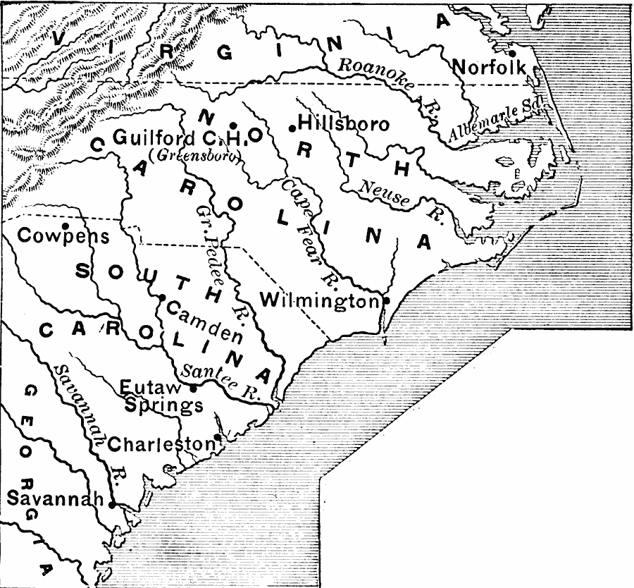
Description: A map of the southern Colonies showing the area of General Nathaneal Greene's campaign (1781) against the British under Charles Cornwallis in the closing years of the American Revolution. The map shows the important sites of Cowpens, Guilford Court House (Greensboro), the British held Savannah, Charleston, and Wilmington, and the site of Eutaw Springs.
Place Names: Early America 1400-1800, Wilmington, �Savannah, �Norfolk, �Hillsboro, �American Revolution, �Colonial America, �Englis
ISO Topic Categories: boundaries,
inlandWaters,
location,
oceans,
intelligenceMilitary
Keywords: Greene's Campaign in the South, physical, �political, �historical, kAmericanRevolution, physical features, major political subdivisions, American Revolution, boundaries,
inlandWaters,
location,
oceans,
intelligenceMilitary, Unknown, 1781
Source: Edward Eggleston, The Household History of the United States and Its People (New York, NY: D. Appleton and Company, 1898) 188
Map Credit: Courtesy the private collection of Roy Winkelman |
|