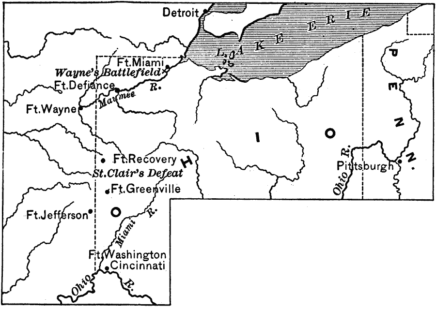
Description: A map of the area in Ohio showing General Anthony Wayne's campaign against the Indians during the Northwest Indian War (1785–1795). The map shows the site of General Arthur St. Clair's defeat near Fort Recovery (November 4, 1791), the sites of Fort Miami, Fort Defiance, Fort Wayne, Fort Recovery, Fort Greenville, Fort Jefferson, and Fort Washington, and the site of Wayne's battlefield on the Maumee River, known as the Battle of Fallen Timbers (August 20, 1794), the final battle of the Northwest Indian War.
Place Names: Early America 1400-1800, Detroit, �Pittsburg, �Cincinnatti, �Native Americans, �Colonial Americ
ISO Topic Categories: intelligenceMilitary,
inlandWaters,
location,
boundaries
Keywords: Campaign in the Northwest, physical, �political, �historical, physical features, major political subdivisions, other military, intelligenceMilitary,
inlandWaters,
location,
boundaries, Unknown, 1794
Source: Edward Eggleston, The Household History of the United States and Its People (New York, NY: D. Appleton and Company, 1898) 220
Map Credit: Courtesy the private collection of Roy Winkelman |
|