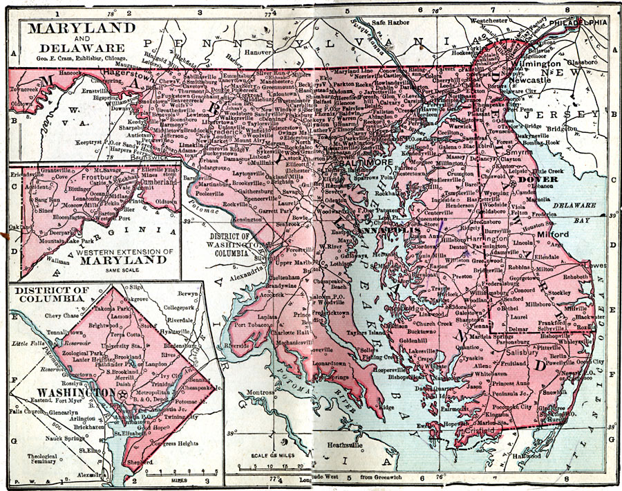
Description: A map from 1906 of Maryland and Delaware showing the capitals of Annapolis and Dover, major cities, towns, and ports, railroads, rivers, and coastline features of the Chesapeake Bay, Delaware Bay, and Atlantic. Inset maps detail the city of Washington and the western extension of Maryland.
Place Names: Maryland, Annapolis, �Baltimore, �Chestertown, �Crisfield, �Easton, �Frederick City, �Hagerston, �Nottingham, �Rockville, �Salisbur
ISO Topic Categories: boundaries,
inlandWaters,
location,
oceans
Keywords: Maryland and Delaware, physical, �political, �borders, �boundaries, �physical features, country borders, boundaries,
inlandWaters,
location,
oceans, Unknown, 1906
Source: George F. Cram , Cram's Quick Reference Atlas and Gazetteer of the World (Chicago , IL: George F. Cram Series of Atlases, 1906) 19
Map Credit: Courtesy the private collection of Roy Winkelman |
|