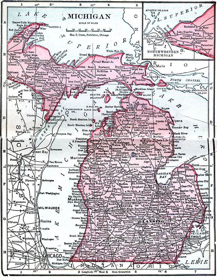
Description: A map from 1906 of Michigan showing the capital city of Lansing, major cities and towns, railroads, rivers, and lake shoreline. An inset map shows the northwestern continuation of the Upper Peninsula.
Place Names: Michigan, Battle Creek, �Detroit, �East Saginaw, �Flint, �Grand Rapids, �Jackson, �Kalamazoo, �Lansing, �Niles, �Pontia
ISO Topic Categories: boundaries,
inlandWaters,
location,
oceans
Keywords: Michigan, physical, �political, �borders, �boundaries, �physical features, country borders, boundaries,
inlandWaters,
location,
oceans, Unknown, 1906
Source: George F. Cram , Cram's Quick Reference Atlas and Gazetteer of the World (Chicago , IL: George F. Cram Series of Atlases, 1906) 23
Map Credit: Courtesy the private collection of Roy Winkelman |
|