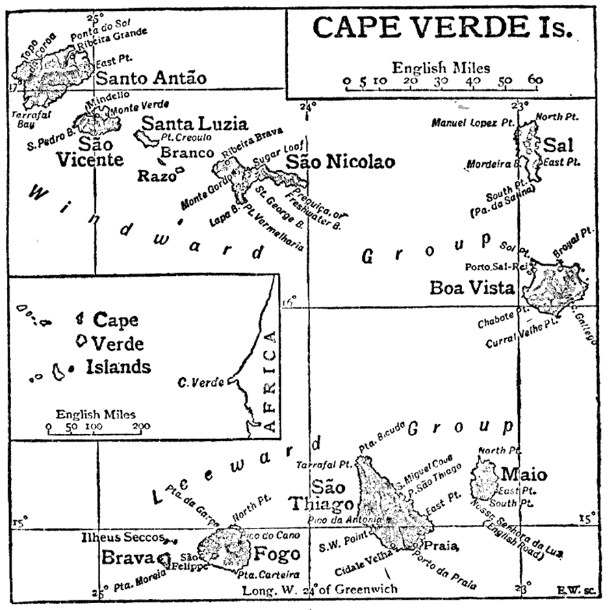
Description: This is a detailed map of the Cape Verde Islands off of Africa. This shows the names of each island, the major cities and the separation of windward and leeward island groups. "Cape Verde Islands, an archipelago belonging to Portugal; off the West African coast. The archipelago consists of ten islands: Santo Antao, Sao Vincente, Santa Luzia, Sao Nicolao, Sal, Boa Vista, Maio, Sao Thiago, Fogo, and Brava, besides four uninhabited islets. It forms a sort of broken crescent, with the concavity towards the west." — The Encyclopedia Britannica, 1910.
Place Names: Cape Verde, Praia, �Mindelo, �Mindello, �Santa Luzia, �Sao Vicente, �Razo, �Santo Antao, �Sao Thiago, �Maio, �Brava, �Fogo, �Sao Nicolao, �Boa Vista, �Windward Group, �Leeward Group, �Sao Felipe, �Atlantic Ocea
ISO Topic Categories: boundaries,
oceans
Keywords: Cape Verde Islands, physical, �political, physical features, major political subdivisions,
country borders, boundaries,
oceans, Unknown,1910
Source: The Encyclopedia Britannica , The Encyclopedia Britannica 11th Edition Vol. 5 (New York, NY: The Encyclopedia Britannica Company, 1910) 253
Map Credit: Courtesy the private collection of Roy Winkelman |
|