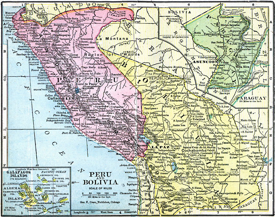
Description: A map of Peru and Bolivia from 1906 showing the political boundaries at that time. The map shows the capital cities of Lima (Peru) and La Paz (Bolivia), major cities, towns, and ports, railroads, rivers, lakes, mountains and terrain, and coastal features along the Pacific. Two inset maps detail Paraguay and the Galapagos Islands. The Galapagos Island inset map uses the British names for the islands.
Place Names: A Regional Map of South America, Bolivia, �Per
ISO Topic Categories: boundaries,
inlandWaters,
location,
oceans
Keywords: Peru and Bolivia, physical, �political, �borders, �boundaries, �physical features, country borders, boundaries,
inlandWaters,
location,
oceans, Unknown, 1906
Source: George F. Cram , Cram's Quick Reference Atlas and Gazetteer of the World (Chicago , Illinois : George F. Cram Series of Atlases, 1906) 70
Map Credit: Courtesy the private collection of Roy Winkelman |
|