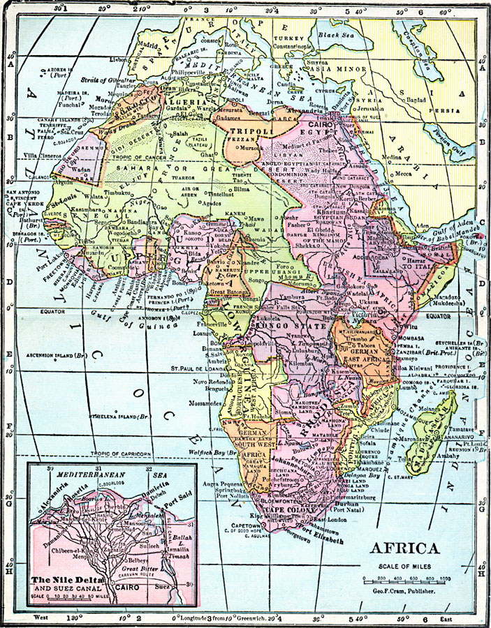
Description: A map of African countries and European territorial claims in 1906, showing major cities and trade centers, major rivers and landforms, and trade routes. An Inset map details the Nile Delta and Suez Canal, showing the Suez and the Canal of Rashid, railroad routes, and the caravan route from Suez to Cairo.
Place Names: A Complete Map of Africa, Algeria, �Congo, �Egypt, �Ethiopia, �Lybia, �Madagascar, �Nigeria, �Somalia, �South Africa, �Sudan, �Kamerun, �Angola, �Belgian Congo, �Abyssinia, �Rhodesia, �Sahara, �Tripoli, �Liberia, �Ivory Coast, �Sierra Leone, �Rio de Oro, Anglo Egyptian Condominion Desert, British East Africa, German East Africa, Kongo State, Upper Guinea, Lower Guinea, Portuguese West Africa, Portuguese West Africa, German Southwest Africa, Cairo, Port Said, Suez, Alexandria
ISO Topic Categories: boundaries,
inlandWaters,
location,
oceans
Keywords: Africa, physical, �political, �borders, �boundaries, kBerlinConference, kSuezCanal, physical features, country borders, boundaries,
inlandWaters,
location,
oceans, Unknown, 1906
Source: George F. Cram , Cram's Quick Reference Atlas and Gazetteer of the World (Chicago , Illinois : George F. Cram Series of Atlases, 1906) 88
Map Credit: Courtesy the private collection of Roy Winkelman |
|