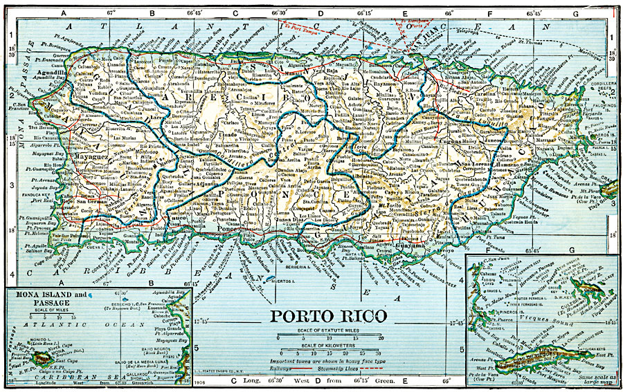
Description: A map from 1919 of Porto Rico (Puerto Rico) with inset maps of the islands to the west and east belonging to Puerto Rico. The map shows the capital of San Juan, major cities and towns, steamship lines, railways, lakes and rivers, mountains, coastal features, and smaller neighboring islands.
Place Names: Puerto Rico, Aguadilla, �Bayamon, �Caguas, �Carolina, �Fajardo, �Guayama, �Mayaguez, �Ponce, �San Jua
ISO Topic Categories: boundaries,
location,
inlandWaters,
oceans
Keywords: Puerto Rico, transportation, �physical, �political, physical features, county borders,
local jurisdictions, railroads,
water routes, boundaries,
location,
inlandWaters,
oceans, Unknown, 1920
Source: John C. Winston, Winston's New and Complete Atlas of the World (New York, NY: The John C. Winston Company, 1920) 108
Map Credit: Courtesy the private collection of Roy Winkelman |
|