Maps Site map
  Maps > United States > Puerto Rico
Site Map  

  Record   1   to   10  of   18

A collection of historic and contemporary political and physical maps of Puerto Rico, including colonial period maps, for use in the K-12 classroom.

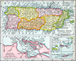
Puerto Rico, 1898
A map from 1898 of Puerto Rico showing the capital of San Juan, departments, principal cities and towns, mountains, rivers, and coastal features. "Puerto Rico was ceded to the United States at the close of the Spanish war. It is a compact little...

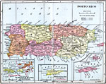
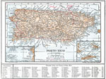
Porto Rico, 1901
A map from 1901 of the island of Puerto Rico, showing departments, main roads, cart roads, railroads, towns, and cities. Inset maps detail San Juan and Port San Juan, and the islands to the east of Puerto Rico....

Puerto Rico, 1903
A map from 1903 of Puerto Rico, here referred to as Porto Rico. The map shows the capital San Juan, principal towns and ports, and neighboring islands....

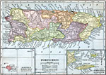
Porto Rico, 1906
A map from 1906 of Porto Rico (Puerto Rico) with inset maps detailing the Danish West Indies (St. Thomas and St. John) and British Virgin Islands, Santa Cruz (St. Croix), and the islands of Culebra and Crab Island (Isla de Vieques). The map shows the...

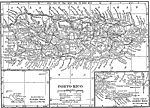
Porto Rico, 1906
A map from 1906 of Puerto Rico showing the major cities and departments (political subdivisions), and the three major railroads at the time....

Porto Rico, 1909
A map from 1909 of Porto Rico (Puerto Rico) with inset maps of the islands to the west and east belonging to Porto Rico. The map shows the capital of San Juan, major cities and towns, existing and proposed railways, main roads and cart roads, lakes a...

Porto Rico, 1912
A map from 1912 of Porto Rico (Puerto Rico) with inset maps of the islands to the west and east belonging to Porto Rico. The map shows the capital of San Juan, departments, major cities and towns, existing and proposed railways, main roads, lakes and...

Porto Rico, 1914
A map from 1914 of Porto Rico (Puerto Rico) with inset maps of the islands to the west and east belonging to Porto Rico. The map shows the capital of San Juan, major cities and towns, steamship lines, railways, lakes and rivers, mountains, coastal fe...

Puerto Rico and Neighboring Islands, 1916
A map from 1916 of Puerto Rico, St. Thomas, St. Croix, and St. John showing terrain and coastal features, rivers, principal cities, towns, and ports, and railroads. The map uses color–contouring to show land elevations from sea level to over 20...

Porto Rico, 1919
A map from 1919 of Porto Rico (Puerto Rico) with inset maps of the islands to the west and east belonging to Porto Rico. The map shows the capital of San Juan, major cities and towns, steamship lines, railways, lakes and rivers, mountains, coastal fe...

Next Last


  Maps > United States > Puerto Rico
Site Map  

Maps ETC is a part of the Educational Technology Clearinghouse
Produced by the Florida Center for Instructional Technology © 2009
College of Education, University of South Florida