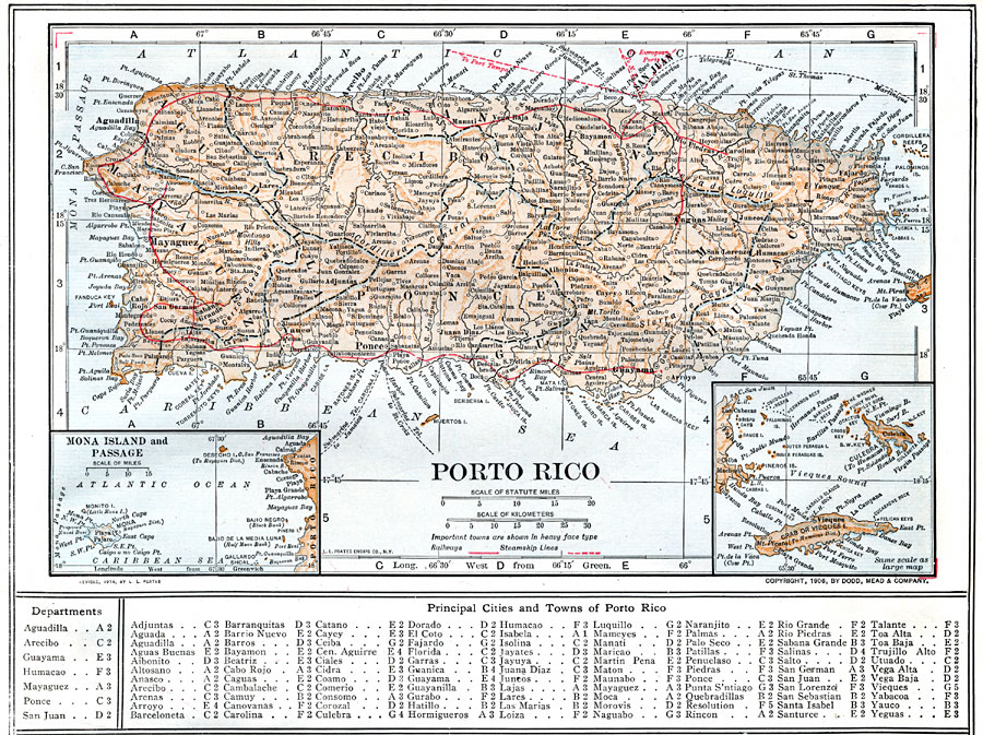
Description: A map from 1914 of Porto Rico (Puerto Rico) with inset maps of the islands to the west and east belonging to Porto Rico. The map shows the capital of San Juan, major cities and towns, steamship lines, railways, lakes and rivers, mountains, coastal features, and smaller neighboring islands. A grid reference at the bottom of the map lists departments, principal cities, and towns of Puerto Rico.
Place Names: Puerto Rico, San Juan, �Fajardo, �Aguadilla, �Bayamon, �Caguas, �Carolina, �Guanica, �Guayama, �Mayaguez, �Ponc
ISO Topic Categories: boundaries,
location,
oceans,
inlandWaters,
transportation
Keywords: Porto Rico, physical, �political, �transportation, physical features, county borders, railroads,
water routes, boundaries,
location,
oceans,
inlandWaters,
transportation, Unknown, 1914
Source: , The New Encyclopedic Atlas and Gazetteer of the World (New York, NY: P. F. Collier and Son, 1914) 47
Map Credit: Courtesy the private collection of Roy Winkelman |
|