Maps Site map
  Maps > United States > Puerto Rico
Site Map  

  Record   11   to   18  of   18

A collection of historic and contemporary political and physical maps of Puerto Rico, including colonial period maps, for use in the K-12 classroom.
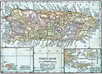
Porto Rico, 1920
A map from 1920 of Porto Rico (Puerto Rico) with inset maps of the islands to the west and east belonging to Porto Rico. The map shows the capital of San Juan, major cities and towns, existing and proposed railways, main roads and cart roads, lakes a...

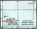
Islands West of Porto Rico, 1920
A map from 1920 of the islands east of Porto Rico, including Mona, Monito, and Desecheo....

Islands East of Porto Rico, 1920
A map from 1920 of the islands east of Porto Rico, including Vieques, Culebra, and the smaller islands and cays....

Economic and Commercial Activity in Porto Rico, 1920
A map from 1920 of Porto Rico and the Virgin Islands showing the economic and commercial activity, including principal products, railroad transportation, and import and export information....

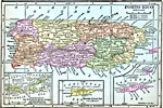
Porto Rico, 1920
A map from 1920 of Porto Rico (Puerto Rico) with inset maps detailing the Danish West Indies (St. Thomas and St. John) and British Virgin Islands, Santa Cruz (St. Croix), and the islands of Culebra and Crab Island (Isla de Vieques). The map shows the...

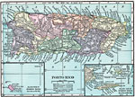
Porto Rico, 1920
A map from 1920 of Porto Rico (Puerto Rico) with inset maps of the islands to the west and east belonging to Porto Rico. The map shows the capital of San Juan, major cities and towns, existing and proposed railways, main roads and cart roads, lakes a...

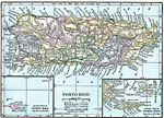
Porto Rico, 1920
A map from 1920 of Porto Rico (Puerto Rico) with inset maps of the islands to the west and east belonging to Porto Rico. The map shows the capital of San Juan, major cities and towns, existing and proposed railways, main roads and cart roads, lakes a...

Puerto Rico, 1920
A map from 1919 of Porto Rico (Puerto Rico) with inset maps of the islands to the west and east belonging to Puerto Rico. The map shows the capital of San Juan, major cities and towns, steamship lines, railways, lakes and rivers, mountains, coastal f...

First Previous


  Maps > United States > Puerto Rico
Site Map  

Maps ETC is a part of the Educational Technology Clearinghouse
Produced by the Florida Center for Instructional Technology © 2009
College of Education, University of South Florida