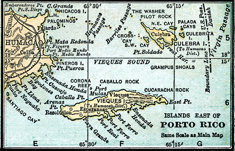
Description: A map from 1920 of the islands east of Porto Rico, including Vieques, Culebra, and the smaller islands and cays.
Place Names: Puerto Rico, Vieques Island, �Humacao, �Culebra Island, �Porto Rico, �Resolution, �Palada Cays, �Santiago Cay, �Ceib
ISO Topic Categories: boundaries,
inlandWaters,
location,
oceans
Keywords: Islands East of Porto Rico, physical, �political, �transportation, physical features, railroads,
roads, boundaries,
inlandWaters,
location,
oceans, Unknown, 1920
Source: , Leslie's New World Atlas (New York City, NY: Leslie-Judge Company, 1920) 36
Map Credit: Courtesy the private collection of Roy Winkelman |
|