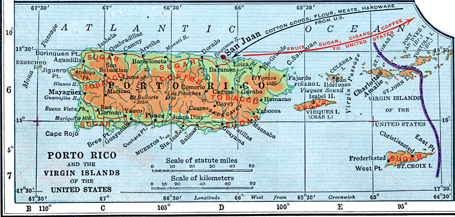
Description: A map from 1920 of Porto Rico and the Virgin Islands showing the economic and commercial activity, including principal products, railroad transportation, and import and export information.
Place Names: Puerto Rico, Mayaguez, �Aguadilla, �San Juan, �Ponce, �Guayama, �Fajardo, �Bayamo
ISO Topic Categories: economy,
inlandWaters,
location,
transportation
Keywords: Economic and Commercial Activity in Porto Rico, physical, �transportation, physical features, railroads,
water routes, economy,
inlandWaters,
location,
transportation, Unknown, 1920
Source: Wallace W. Atwood, New Geography: Book Two (Boston, MA: Ginn and Company, 1920) 118
Map Credit: Courtesy the private collection of Roy Winkelman |
|
