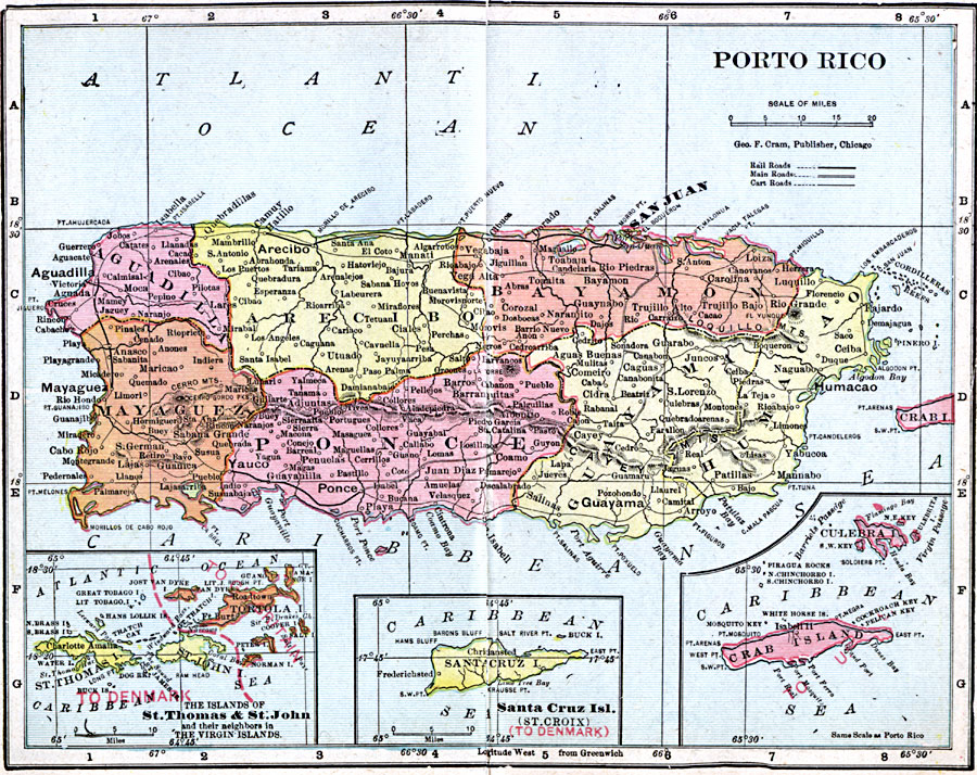
Description: A map from 1906 of Porto Rico (Puerto Rico) with inset maps detailing the Danish West Indies (St. Thomas and St. John) and British Virgin Islands, Santa Cruz (St. Croix), and the islands of Culebra and Crab Island (Isla de Vieques). The map shows the capital of San Juan, major cities and towns, railways, main roads and cart roads, lakes and rivers, mountains, coastal features, and smaller neighboring islands. The map shows the Crab Island as a possession of the United States at the time.
Place Names: Puerto Rico, Puerto Ric
ISO Topic Categories: boundaries,
inlandWaters,
location,
oceans
Keywords: Porto Rico, physical, �political, �borders, �boundaries, kCaribbean, physical features, country borders, boundaries,
inlandWaters,
location,
oceans, Unknown, 1906
Source: George F. Cram , Cram's Quick Reference Atlas and Gazetteer of the World (Chicago , IL: George F. Cram Series of Atlases, 1906) 67
Map Credit: Courtesy the private collection of Roy Winkelman |
|