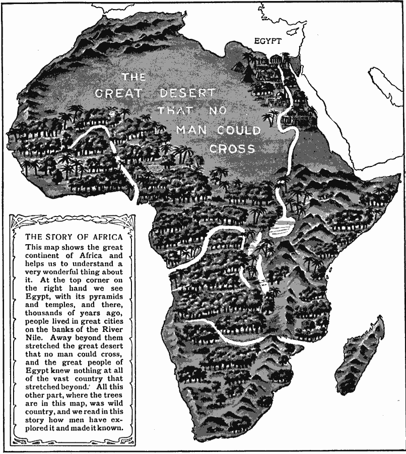
Description: A stylized relief map of Africa, showing the Sahara, major rivers and lakes, mountains, "wild country," and other features. The Sahara is labeled as "The Great Desert that No Man Could Cross." with pyramids and temples drawn along the Nile River. The vast majority of the map is shown covered in thick trees, indicating the wild lands that awaited European exploration.
Place Names: A Complete Map of Africa, Sahara, Egypt, Nile River
ISO Topic Categories: inlandWaters,
oceans
Keywords: The Story of Africa, physical, physical features, inlandWaters,
oceans, Unknown, 1912
Source: Arthur Mee and Holland Thompson, Ph.D., The Book of Knowledge Vol 1 (New York, NY: The Grolier Society, 1912) 281
Map Credit: Courtesy the private collection of Roy Winkelman |
|