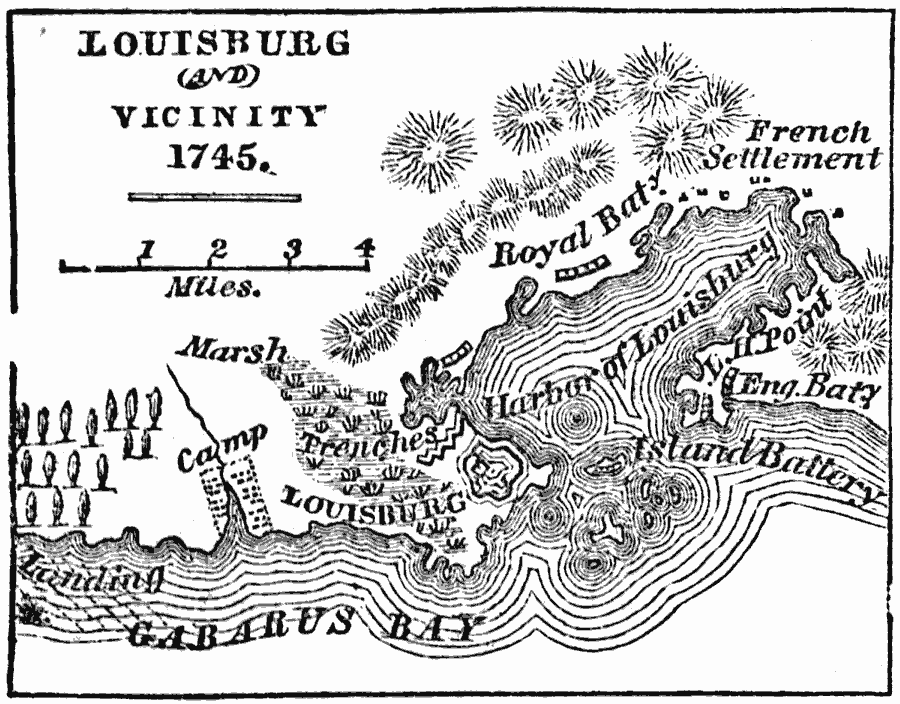
Description: A map of Louisburg and vicinity on Cape Breton (French — Isle Royal) in 1745 during King George's War. The map shows the French fortified settlement of Louisburg and the area of the campaign of the British under Pepperell, Wolcott, and Commodore Warren during the siege and capture of Louisburg. The map shows the landing site and camp of the British on Gabarus Bay, Louisburg with its trench defenses in the marshland, Light House Point across the harbor, and the Royal and British battery positions.
Place Names: Canada, Louisbur
ISO Topic Categories: biota,
inlandWaters,
location
Keywords: Louisburg and Vicinity, physical, �statistical, physical features, vegetation, biota,
inlandWaters,
location, Unknown, 1745
Source: Marcius Willson, History of the United States (New York, NY: Ivison, Blakeman, Taylor, and Co., 1872) 98
Map Credit: Courtesy the private collection of Roy Winkelman |
|