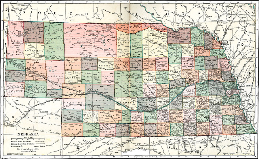
Description: A map from 1920 of Nebraska showing the capital of Lincoln, counties and county seats, major cities and towns, railroads, National Forest boundaries, Military reserve boundaries, and rivers.
Place Names: Nebraska, Aldine, �Ashbrook, �Curly, �Harrisburg, �Alliance, �Wood Lake, �King, �North Platte, �Bertha, �McCook, �Holdrege, �Kearney, �Grand Island, �Hastings, �Red Cloud, �Superior, �Aurora, �Central City, �Fullerton, �Fairfield, �Sutton, �Norfolk, �Madison, �C
ISO Topic Categories: boundaries,
inlandWaters,
location,
transportation
Keywords: Nebraska, physical, �political, �transportation, physical features, major political subdivisions,
county borders, roads,
railroads, boundaries,
inlandWaters,
location,
transportation, Unknown, 1920
Source: , Leslie's New World Atlas (New York City, NY: Leslie-Judge Company, 1920) 86-87
Map Credit: Courtesy the private collection of Roy Winkelman |
|