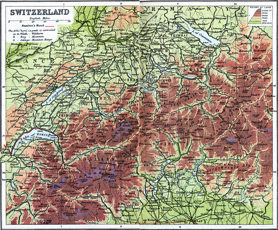
Description: A map of Switzerland in 1910, showing major cities and towns, railroads, rivers, lakes, and terrain. Elevations are shown as color–contours ranging from sea level to 3,000 feet in greens, 3–12,000 feet in browns, and above 12,000 feet in purple. The map also shows the route of Napoleon through the Alps to Italy in 1800 during the War of the Second Coalition (1799–1802).
Place Names: Switzerland, Alps, �Basel, �Bern, �Biel, �Chur, �Fribourg, �Geneva, �Grisons, �Lausanne, �Lugano, �Vallais, �Vaud, �Winterthur, �Zuric
ISO Topic Categories: inlandWaters,
location,
oceans
Keywords: Switzerland, physical, �physical features, �topographical, �political, �country borders, topographical,
physical features, country borders, inlandWaters,
location,
oceans, Unknown, 1910
Source: J.G. Bartholomew, LLD, A Literary & Historical Atlas of Europe (New York, New York: E.P. Dutton & Co., Ltd. , 1910) 86-87
Map Credit: Courtesy the private collection of Roy Winkelman |
|