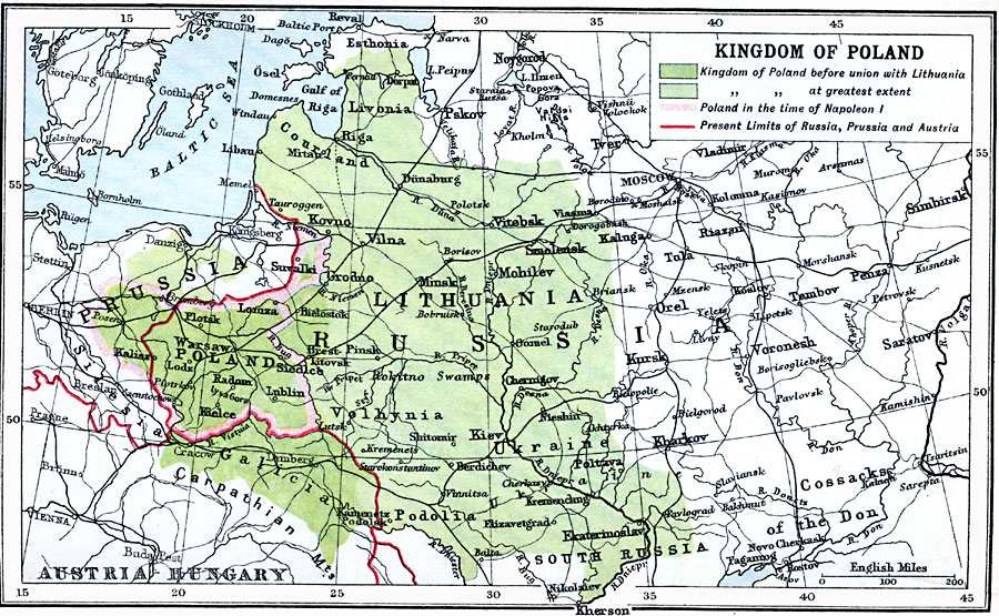
Description: A map of the Kingdom of Poland. This map is color–coded to show the kingdom before its union with the Duchy of Lithuania in 1569 in darker green, its greatest extent as the Polish–Lithuanian Commonwealth in green, and the extent of Poland in the time of Napoleon I in light green. The red line delineates the 1910 limits of Russia, Prussia, and Austria after the third partition of Poland in 1795. The map shows major cities, railways, rivers, and terrain of the area.
Place Names: Poland, Lodz, �Lublin, �Radom, �Warsaw,
ISO Topic Categories: inlandWaters,
location,
oceans
Keywords: Kingdom of Poland, physical, �physical features, �topographical, �political, �country borders, topographical,
physical features, country borders, inlandWaters,
location,
oceans, Unknown, 1560
Source: J.G. Bartholomew, LLD, A Literary & Historical Atlas of Europe (New York, New York: E.P. Dutton & Co., Ltd. , 1910) 92
Map Credit: Courtesy the private collection of Roy Winkelman |
|