|
|
|
| Maps > Europe > Poland |
Historic and contemporary maps of Poland, including political and physical maps, early empires, city plans, and the partition of the country.
|
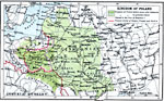
Kingdom of Poland,
1560 |
|
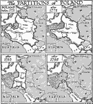
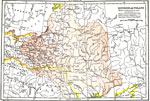
Partitions of Poland,
1772–1795 |

|
Partitions of Poland,
1772–1795 |
|
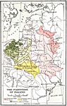
The Partition of Poland,
1772–1795 |
|
Partition of Poland,
1772–1795 |
|
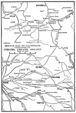
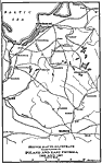
Sketch Map to Illustrate Campaigns in Poland and East Prussia,
1806 and 1807 |
|
Kingdom of Poland,
1903 |
|
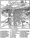
Plan of Posen,
1903 |

|
Poland,
1914–1919 |
|
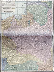
Poland and Neighboring Countries,
1922 |
| Maps > Europe > Poland |
Maps ETC is a part of the Educational Technology Clearinghouse
Produced by the Florida Center for Instructional Technology © 2009
College of Education, University of South Florida