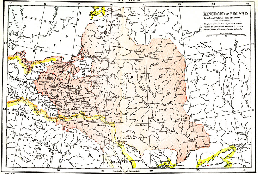
Description: "Poland was till towards the end of the 18th century a large and powerful kingdom, extending with Lithuania, which was incorporated with it, over the basins of the Warta, Vistula, Dwina, Dnieper, and upper Dniester, and having under its dominion, besides the Poles proper and the Baltic Slavs, the Lithuanians, the White Russians, and the Little Russians, or Ruthenians." (— Kellogg, 1903)
Place Names: Poland, Poland, �Ukraine, �Lithuania, �Baltic Sea,
ISO Topic Categories: boundaries,
inlandWaters
Keywords: Kingdom of Poland, physical, �political, physical features, country borders,
major political subdivisions, boundaries,
inlandWaters, Unknown,1903
Source: Day Otis Kellogg, D.D., Encyclopedia Britannica Vol. XIX (New York, NY: The Werner Company, 1903) 288
Map Credit: Courtesy the private collection of Roy Winkelman |
|