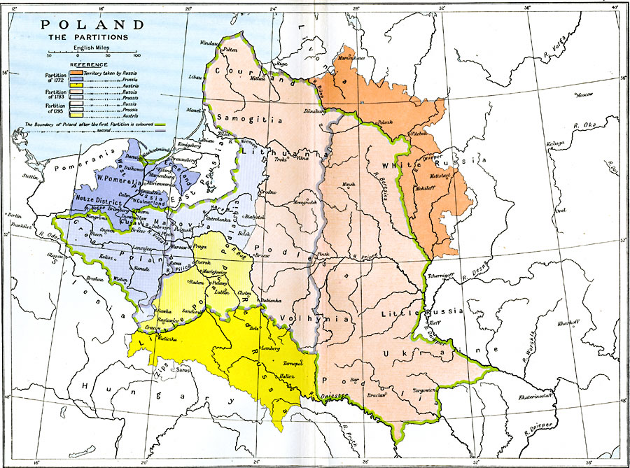
Description: Map of Poland between the First Partition in 1772 and the Third Partition in 1795. Prior to the territorial partitions by Prussia, Russia, and the Habsburg Austrians, the area was known as the Polish–Lithuanian Commonwealth formed by the union of the Kingdom of Poland and the Grand Duchy of Lithuania, and included West Pomerrelia, Ermeland, Courland, Samogitia, Podlersia, Podlachia, Masovia, and Volhynia. This map is color–coded to show the territories taken by Russia, Prussia, and Austria in the First Partition of 1772, Russia and Prussia in the Second Partition of 1793, and Russia, Prussia, and Austria in the Third Partition of 1795, which eliminated the commonwealth altogether. The map shows major cities and rivers of the region, and includes portions of neighboring Livonia, White Russia, Red Russia, Little Russia, Ukraine, Hungary, Silesia, and Pomerania.
Place Names: Poland, Austria, �Lithuania, �Poland, �Prussia, �Russia, �Ukrain
ISO Topic Categories: oceans,
location,
inlandWaters,
boundaries
Keywords: Partitions of Poland, political, �historical, kPartitionOfPoland, local jurisdictions,
country borders, historical event,
other military, oceans,
location,
inlandWaters,
boundaries, Unknown, 1772–1795
Source: Ward, Prothero, and Leathes, The Cambridge Modern History Atlas (New York, NY: The Macmillan Company, 1912)
Map Credit: Courtesy the private collection of Roy Winkelman |
|