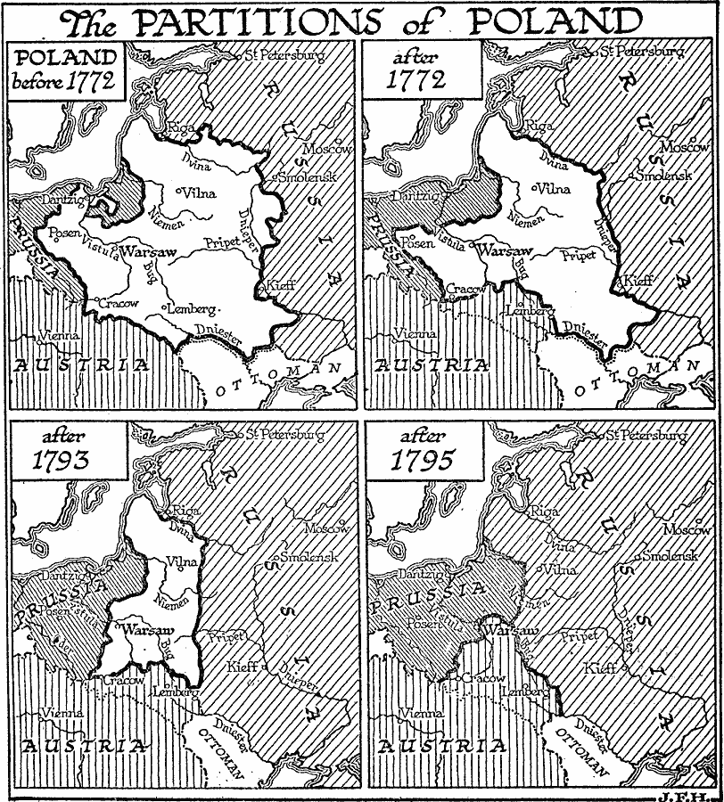
Description: A map showing the partitioning of Poland between 1772 and 1795. The map shows Poland before 1772, and the three territorial annexations by Prussia, Russia, and Austria in 1772, 1793, and 1795.
Place Names: Poland, Warsaw, �Krako
ISO Topic Categories: location,
oceans,
inlandWaters,
boundaries
Keywords: Partitions of Poland, physical, �political, physical features, country borders, location,
oceans,
inlandWaters,
boundaries, Unknown, 1772–1795
Source: H. G. Wells, The Outline of History (New York, NY: The Macmillan Company, 1921) 800
Map Credit: Courtesy the private collection of Roy Winkelman |
|