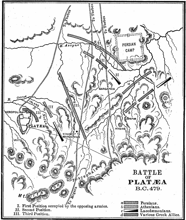
Description: A map showing the Battle of Platæa, during the second Persian invasion of Greece in 479 BC. The battle was fought near the city of Platæa in Boeotia, between the Persian army under Mardonius and a Greek alliance of Athenians, Lacedæmonians, and others under Pausanius. The map shows the fortified camp of the Persians, the strategic terrain used by the Greeks, and the positions of the opposing armies over the course of the battle.
Place Names: Greece, Platæa
ISO Topic Categories: inlandWaters,
location,
intelligenceMilitary
Keywords: Platæa, physical, �transportation, �political, kAncientGreece, kBattle, physical features, local jurisdictions, roads, inlandWaters,
location,
intelligenceMilitary, Unknown, 479 BC
Source: Phillip Van Ness Myers, L.H.D., A History of Greece (Boston, MA: Ginn and Company, 1897) 218
Map Credit: Courtesy the private collection of Roy Winkelman |
|