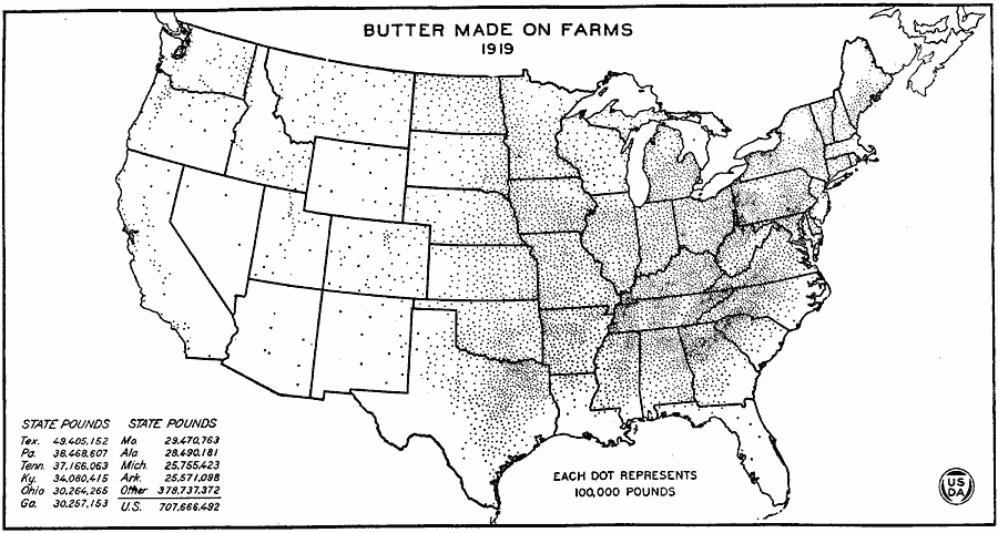
Description: A map of the United States from the U. S. Department of Agriculture (1922) showing butter production on farms by state in 1919.
Place Names: Agriculture, Texas, Pennsylvania, Tennessee, Kentucky, Ohio, Georgia, Missouri, Alabama, Michigan, Arkansas, �butte
ISO Topic Categories: farming,
boundaries,
economy,
inlandWaters
Keywords: Butter Made on Farms, physical, �political, �statistical, �butter made on farms in 1919, butter production by state on farms, kAgriculture, physical features, country borders,
major political subdivisions, agriculture,
economic, farming,
boundaries,
economy,
inlandWaters, Unknown, 1919
Source: , United States Department of Agriculture Yearbook 1922 (Washington, DC: Government Printing Office, 1923) 313
Map Credit: Courtesy the private collection of Roy Winkelman |
|