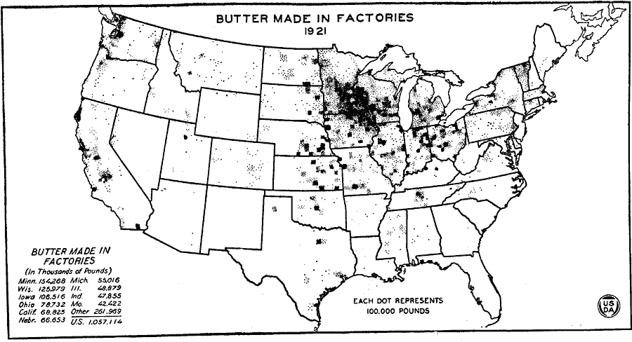
Description: A map of the United States from the U. S. Department of Agriculture (1922) showing butter production in factories by state in 1921.
Place Names: Agriculture, Minnesota, Wisconsin, Iowa, Ohio, California, Nebraska, Michigan, Illinois, Indiana, Missouri, �butte
ISO Topic Categories: farming,
boundaries,
economy,
inlandWaters
Keywords: Butter Made in Factories, physical, �political, �statistical, �butter made in factories by states in 1921, butter production by state in 1921, kAgriculture, physical features, country borders,
major political subdivisions, agriculture,
economic,
industry, farming,
boundaries,
economy,
inlandWaters, Unknown, 1921
Source: , United States Department of Agriculture Yearbook 1922 (Washington, DC: Government Printing Office, 1923) 314
Map Credit: Courtesy the private collection of Roy Winkelman |
|