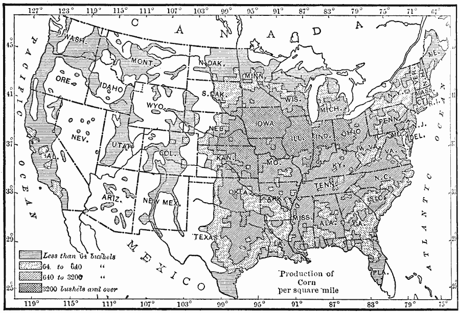
Description: A map from 1910 of the United States showing the corn producing regions at the time. The map is keyed to show areas of corn production ranging from less than 64 bushels per square mile to 3,200 bushels and over based on records from 1906.
Place Names: Agriculture, cor
ISO Topic Categories: boundaries,
farming,
inlandWaters,
location,
oceans
Keywords: Corn Production in the United States, physical, �political, �statistical, kAgriculture, physical features, major political subdivisions,
country borders, agriculture, boundaries,
farming,
inlandWaters,
location,
oceans, Unknown, 1910
Source: Ralph S. Tarr, B.S., F.G.S.A. and Frank M. McMurry, Ph.D., New Geographies 2nd ed (New York, NY: The Macmillan Company, 1910) 182
Map Credit: Courtesy the private collection of Roy Winkelman |
|