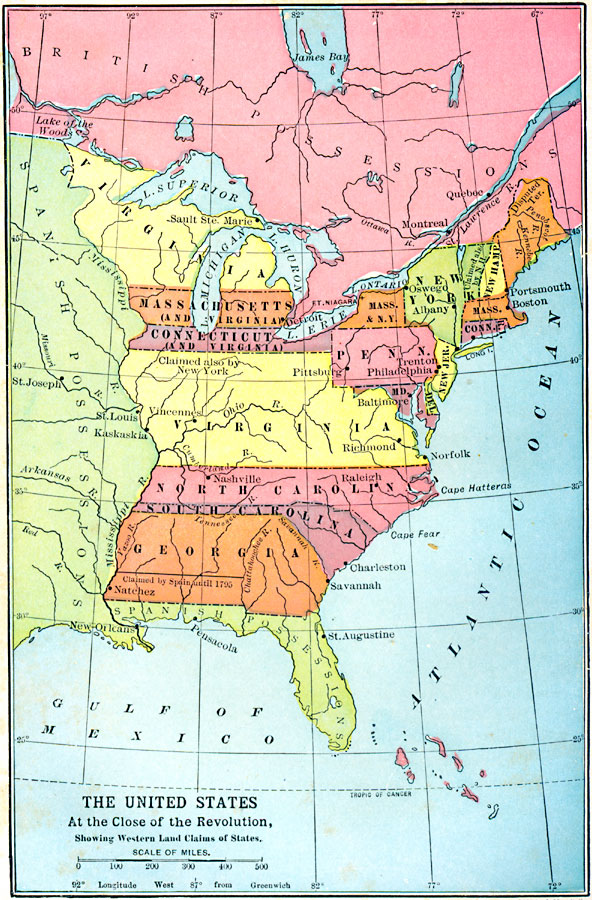
Description: A map of the United States at the close of the American Revolution showing the western land claims extending to the Mississippi River by the individual states after the Treaty of 1783 with Britain. The map shows the frontiers with the British possessions to the north, and the Spanish possessions to the west of the Mississippi River and the Florida territories, including the disputed territory in southern Georgia (now Alabama and Georgia) between Spain and the United States. The map shows territories claimed by more than one of the states, especially in the case of Virginia, which claimed lands from Lake of the Woods in the north, the entire Michigan Peninsula, and everything south to the North Carolina line.
Place Names: Early America 1400-1800, Connecticut, �Delaware, �Georgia, �Maryland, �Massachusetts, �New Hampshire, �New Jersey, �New York, �North Carolina, �Pennsylvania, �South Carolina, �Virginia, �American Revolutio
ISO Topic Categories: location,
oceans,
inlandWaters,
boundaries
Keywords: The United States at the Close of the Revolution, Showing Land Claims of States, American Revolution, �borders, �historical, �political, ��country borders,
county borders, historical event,
American Revolution, location,
oceans,
inlandWaters,
boundaries, Unknown, 1911
Source: John Clark Ridpath , History of the United States from Aboriginal Times to Taft's Administration (vol. 2) (New York, NY: The Review of Reviews Company, 1911)
Map Credit: Courtesy the private collection of Roy Winkelman |
|