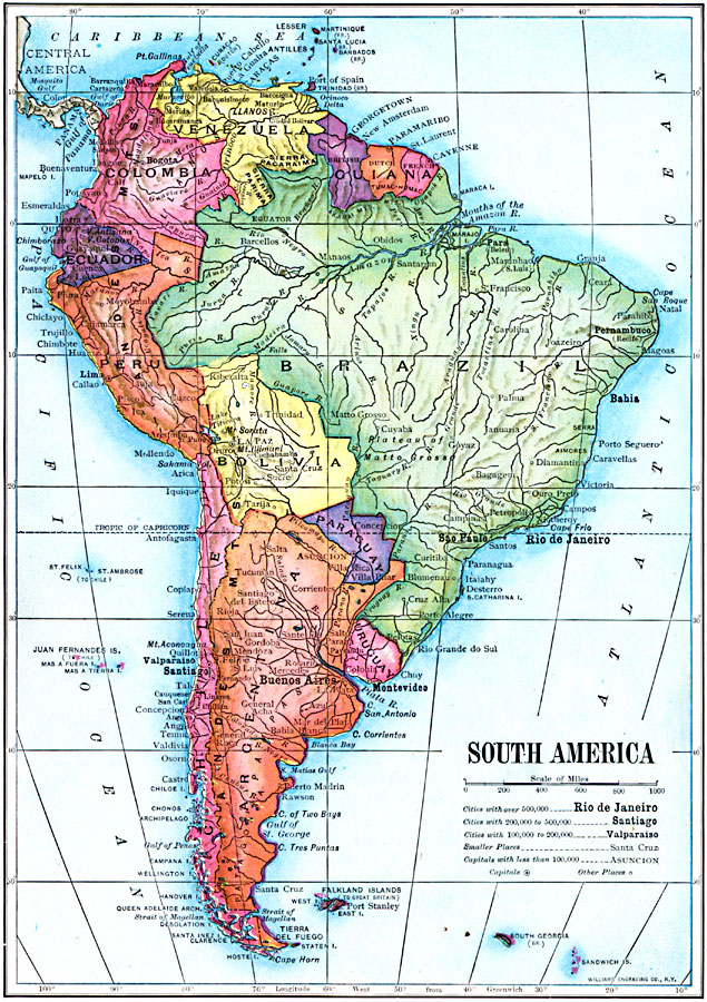
Description: A map of South America from 1910 showing the political boundaries of the time. The map shows capitals, major cities, ports, rivers, terrain and coastal features. The size of city labels indicate general population of the city at the time.
Place Names: A Complete Map of South America, Argentina, �Bolivia, �Brazil, �Chile, �Columbia, �Ecuador, �Paraguay, �Peru, �Venezuela, �Uraguay, �Guian
ISO Topic Categories: inlandWaters,
location,
oceans,
boundaries
Keywords: South America, physical, �political, physical features, country borders, inlandWaters,
location,
oceans,
boundaries, Unknown, 1910
Source: Ralph S. Tarr, B.S., F.G.S.A. and Frank M. McMurry, Ph.D., New Geographies 2nd ed (New York, NY: The Macmillan Company, 1910) 236
Map Credit: Courtesy the private collection of Roy Winkelman |
|