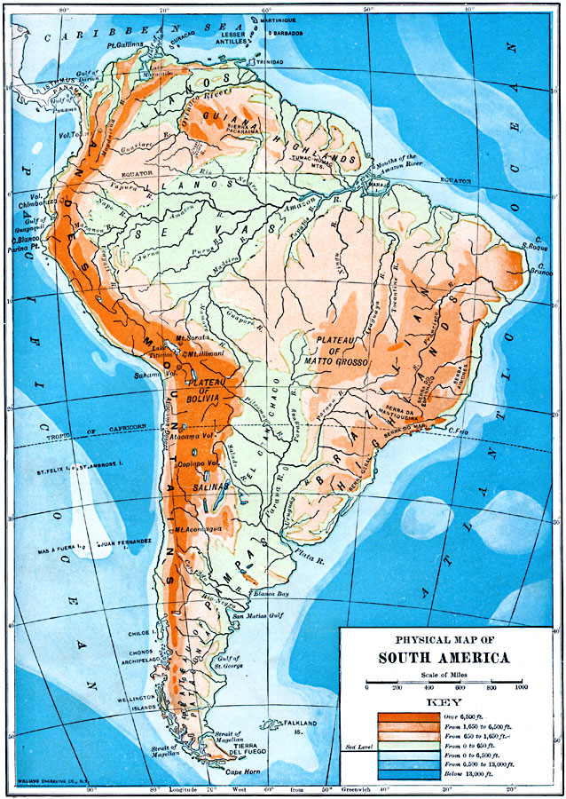
Description: A physical map from 1910 of South America showing color–contoured land elevations and water depths. Elevations range from sea level to over 6,500 feet, and water depths range from sea level to below 13,000 feet. This map shows the Caribbean Sea, Atlantic, and Pacific, coastal features, volcanoes, prominent peaks, and major rivers, as well as the physiographic regions of Andes Mountains, Llanos, Guiana Highlands, Llanos Selvas, Plateau of Matto Grosso, Brazilian Highlands, Plateau of Bolivia, El Gran Chaco, Salinas, Pampas, and the Plateau of Patagonia.
Place Names: A Complete Map of South America, Argentina, �Chile, �Brazil, �Bolivia, �Columbia, �Ecuador, �Paraguay, �Peru, �Uraguay, �Venezuel
ISO Topic Categories: elevation,
location,
oceans,
inlandWaters
Keywords: Physical Map of South America, physical, physical features, elevation,
location,
oceans,
inlandWaters, Unknown, 1910
Source: Ralph S. Tarr, B.S., F.G.S.A. and Frank M. McMurry, Ph.D., New Geographies 2nd ed (New York, NY: The Macmillan Company, 1910) 237
Map Credit: Courtesy the private collection of Roy Winkelman |
|