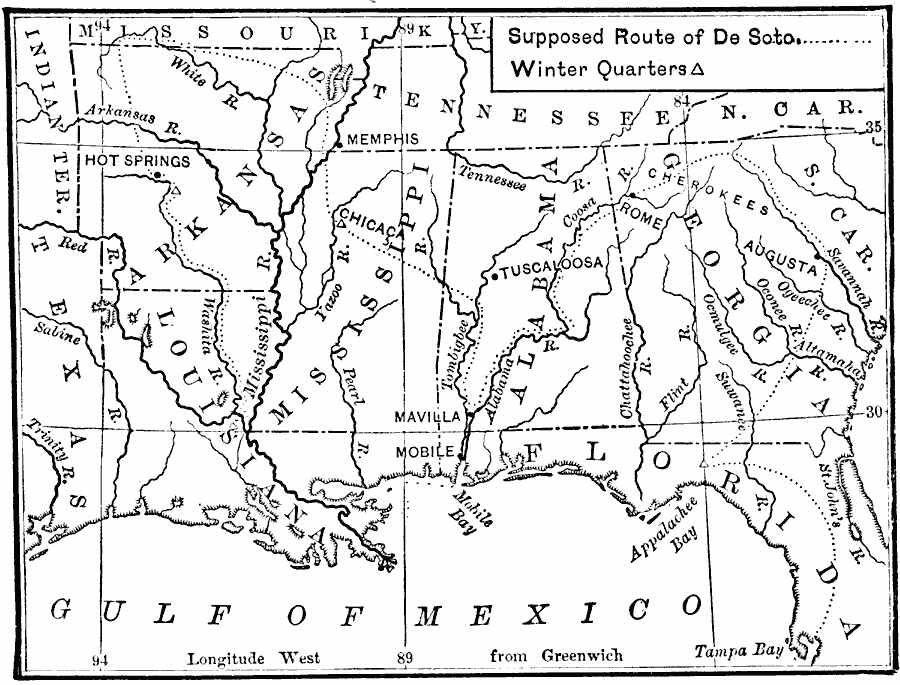
Description: A map of the supposed route of Hernando de Soto's expedition taken from Tampa Bay (1539) to the Mississippi River, first reached in 1541, and the site of his death in 1542. The map shows the winter quarters of the expedition in northern Florida, Chicaca Mississippi, and on the Washita River south of Hot Springs, Arkansas.
Place Names: Early America 1400-1800, Alabama, �Appalachee Bay, �Arkansas, �Florida, �Georgia, �Gulf of Mexico, �Louisiana, �South Carolina, �Tampa Bay, �Washita River, ��Discovery, �Spanis
ISO Topic Categories: oceans,
location,
inlandWaters
Keywords: Route of De Soto, water route, �transportation, water routes, oceans,
location,
inlandWaters, Unknown, 1539–1542
Source: William Swinton, First Lessons in Our Countries History (New York, NY: American Book Company, 1894) 30
Map Credit: Courtesy the private collection of Roy Winkelman |
|