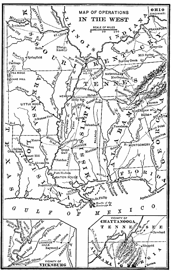
Description: A map of the south–central States showing American Civil War operations in the West (1861–1865). The map shows major cities and towns, rivers, terrain and coastal features, and campaign routes. Inset maps detail the vicinity of Vicksburg and the vicinity of Chattenooga.
Place Names: Civil War, Alabama, �Arkansas, �Florida, �Georgia, �Illinois, �Indiana, �Kentucky, �Mississippi, �Missouri, �Ohio, �Tennesse
ISO Topic Categories: oceans,
location,
inlandWaters
Keywords: Operations in the West, historical, local jurisdictions, water routes, historical event, oceans,
location,
inlandWaters, Unknown, 1861–1865
Source: William Swinton, First Lessons in Our Countries History (New York, NY: American Book Company, 1894) 171
Map Credit: Courtesy the private collection of Roy Winkelman |
|