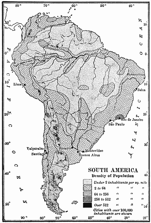
Description: A map showing the population density of South America around 1910. The map shows the regions where population density ranges from under two inhabitants per square mile to regions of population over 512 inhabitants per square mile. Cities with over 100,000 inhabitants are shown, and include the cities of Bogota in the north, Lima, Pernambuca, Bahia, Rio de Janeiro, São Paulo, Valparaiso, Santiago, Rosario, Montevideo, and Buenos Aires.
Place Names: A Complete Map of South America, Lima, �Santiago, �Montevideo, �Buenos Aires, �Sao Paulo, �Rio de Janiero, �Bogot
ISO Topic Categories: inlandWaters,
location,
oceans,
society
Keywords: Population Density of South America, physical, �statistical, kPopulation, physical features, population, inlandWaters,
location,
oceans,
society, Unknown, 1910
Source: Ralph S. Tarr, B.S., F.G.S.A. and Frank M. McMurry, Ph.D., New Geographies 2nd ed (New York, NY: The Macmillan Company, 1910) 242
Map Credit: Courtesy the private collection of Roy Winkelman |
|