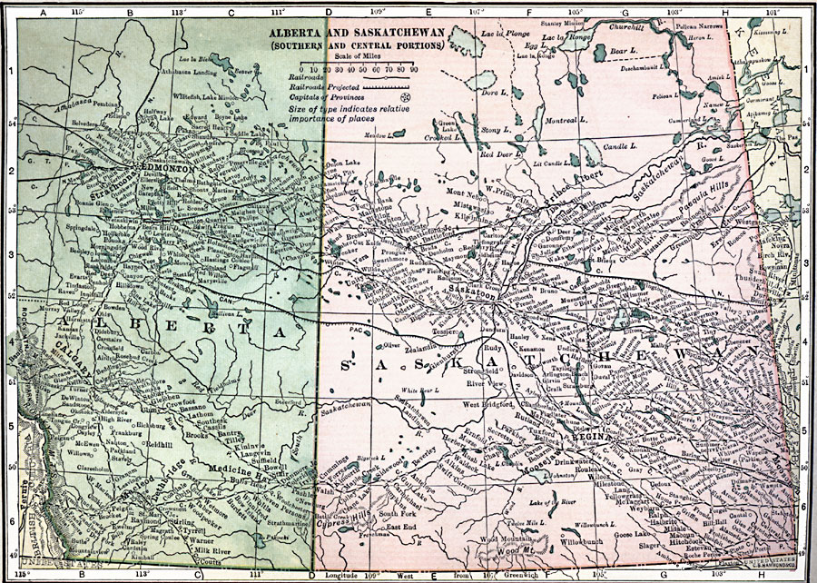
Description: A map from 1909 of the central and southern parts of Alberta and Saskatchewan showing the provincial capitals of Edmonton and Regina, major cities and towns, existing and proposed railways, lakes, and rivers of this portion of the provinces.
Place Names: Canada, Alberta, �Calgary, �Edmonton, �Prince Albert, �Saskatchewan, �Saskatoon,
ISO Topic Categories: oceans,
location,
inlandWaters
Keywords: Alberta and Saskatchewan, borders, �political, �railroad, �transportation, county borders, railroads, oceans,
location,
inlandWaters, Unknown, 1909
Source: C. S. Hammond, Hammond's Handy Atlas of the World (New York, NY: C. S. Hammond & Company, 1911) 14
Map Credit: Courtesy the private collection of Roy Winkelman |
|