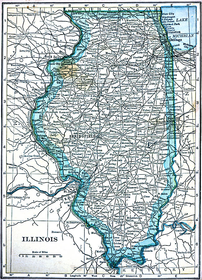
Description: A map from 1909 of Illinois showing the State capital of Springfield, major cities and towns, railroads, canals, the shoreline of Lake Michigan, and the Mississippi and Ohio rivers.
Place Names: Illinois, Belleville, �Champaign, �Chicago, �Decatur, �Illinois, �Lasalle, �Peoria, �Springfiel
ISO Topic Categories: oceans,
location,
inlandWaters
Keywords: Illinois, local jurisdictions, �political, local jurisdictions, oceans,
location,
inlandWaters, Unknown, 1909
Source: C. S. Hammond, Hammond's Handy Atlas of the World (New York, NY: C. S. Hammond & Company, 1911) 43
Map Credit: Courtesy the private collection of Roy Winkelman |
|