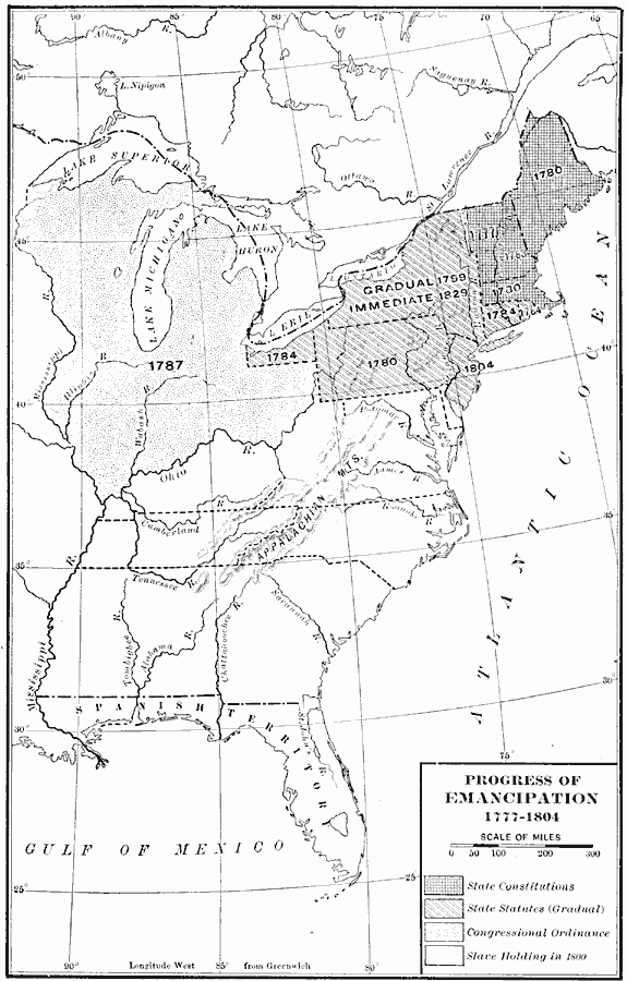
Description: A map of the eastern United States showing the progress of emancipation from 1777 to 1804. The map is coded to show states and territories with dates of emancipation, including States granting emancipation by State Constitution, State Statutes (gradual), territories granting emancipation by Congressional Ordinance, and the slave holding states in 1800.
Place Names: Early America 1400-1800, emancipatio
ISO Topic Categories: boundaries,
location,
oceans,
inlandWaters
Keywords: Progress of Emancipation, physical, �political, physical features, major political subdivisions,
country borders, boundaries,
location,
oceans,
inlandWaters, Unknown, 1777–1804
Source: Albert Bushnell Hart, LL.D., The American Nation Vol 11 (New York, NY: Harper and Brothers, 1906) 184
Map Credit: Courtesy the private collection of Roy Winkelman |
|