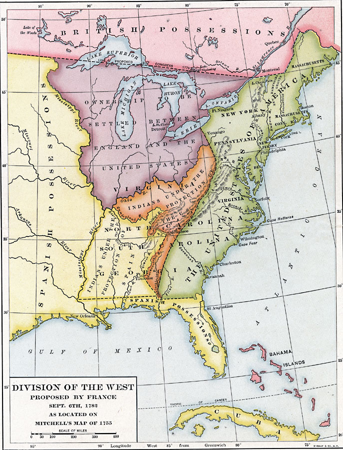
Description: A map of the United States and the division of the West as proposed by France, on September 6th, 1782. The map is color–coded to show the United States at the time, the Indian Reserves south of the Ohio River under the protection of the United States, Spanish possessions, including the Indian Reserves under the protection of Spain, and the British possessions in the Dominion of Canada and the Bahama Islands. The map shows the Northwest Territory, whose ownership was yet to be established between England and the United States, and the boundary line between the United States and the British Canadian possessions proposed by the Congress of 1779.
Place Names: Early America 1400-1800, Boston, �New York, �New Orleans, �Frenc
ISO Topic Categories: boundaries,
location,
inlandWaters,
oceans
Keywords: Division of the West, physical, �political, physical features, country borders,
major political subdivisions, boundaries,
location,
inlandWaters,
oceans, Unknown, 1782
Source: Albert Bushnell Hart, LL.D., The American Nation Vol 10 (New York, NY: Harper and Brothers, 1906) 14
Map Credit: Courtesy the private collection of Roy Winkelman |
|