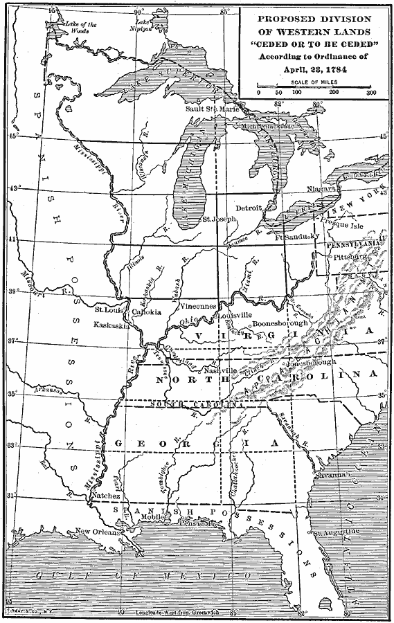
Description: A map of the United States and the Northwest Territory east of the Mississippi River showing the proposed division of western lands ‘ceded or to be ceded’ by the states according to the Ordinance of April 23, 1784. Under this proposed Ordinance by Jefferson, the prior state claims would be ceded and the western lands would be divided into 16 different states, or, if South Carolina and Georgia were allowed to extend westward, 14 states.
Place Names: Early America 1400-1800, Savannah, �Detroit, �St. Louis, �New Orleans, �Pittsbur
ISO Topic Categories: boundaries,
inlandWaters,
location,
oceans
Keywords: Proposed Division of Western Lands, physical, �political, physical features, major political subdivisions, boundaries,
inlandWaters,
location,
oceans, Unknown, 1784
Source: Albert Bushnell Hart, LL.D., The American Nation Vol 10 (New York, NY: Harper and Brothers, 1906) 116
Map Credit: Courtesy the private collection of Roy Winkelman |
|