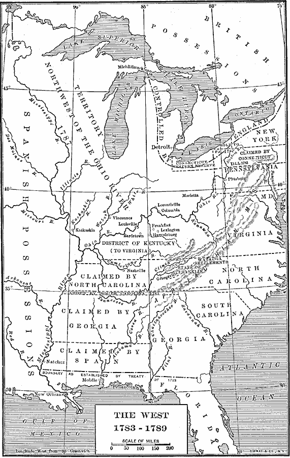
Description: A map of the early United States between 1783 and 1789 showing the territorial State claims west to the Mississippi River, and is keyed to show undefined or disputed boundaries, boundaries of States and territories, and boundaries not settled. The map shows the Spanish possessions west of the Mississippi River and Florida, and the British territories of Canada.
Place Names: Early America 1400-1800, Pittsburg, �Frankfort, �New Orlean
ISO Topic Categories: boundaries,
inlandWaters,
location,
oceans
Keywords: The West, physical, �political, physical features, country borders,
major political subdivisions, boundaries,
inlandWaters,
location,
oceans, Unknown, 1783–1789
Source: Albert Bushnell Hart, LL.D., The American Nation Vol 10 (New York, NY: Harper and Brothers, 1906) 134
Map Credit: Courtesy the private collection of Roy Winkelman |
|